Road map - St Tornberget
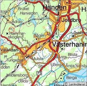
The highpoint of Stockholm is St Tornberget and is situated south of the city, along the hiking trail S—rmlandsleden.
webmaster@sverigestak.org Last modified: Thu Feb 10 21:39:24 W. Europe Standard Time 2005
The highpoint of Stockholm is St Tornberget and is situated south of the city, along the hiking trail S—rmlandsleden.