Topo map - Svinh—jden
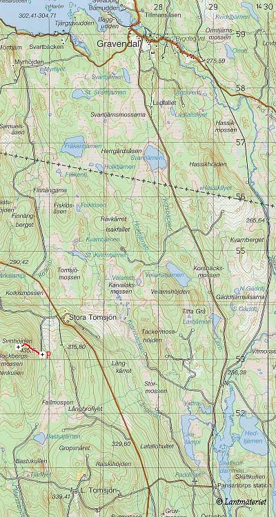
The red trail in the map shows our route up Svinh—jden. Vi hiked straight over the clear-cur area. Since it is easier to follow the northern edge of the clear-cut, we recommend doing so instead. On the summit there is a couple of large boulders, which may help guide the way to the summit (they are probably visible from about 50 m or so).
webmaster@sverigestak.org Last modified: Fri Nov 28 21:45:55 Eastern Standard Time 2003