
Provinces
Counties
Blekinge
Dalarna
Gotland
Halland
Jönköping
Kalmar
Kronoberg
Norrbotten
Skĺne
Stockholm
Södermanland
Uppsala
Värmland
Västmanland
Västra Götaland
Örebro
Östergötland
Other stuff
Home
| Kronoberg: Karryd - 312 m | |
|---|---|
|
Location: West of Norrhult-Klavreström Coordinates: N 57°08.373' E 15°05.427' Exact height: 312 m Hiking: –, drive-up Hiking distance: – Elevation gain: – Maps: Topographic: 5F NV Ĺseda Road map: Any road map All maps from Lantmäteriet |
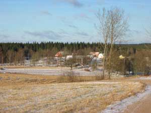 Click in the picture to see more pictures. |
Approach:
From the intersection between Rt 23 and Rt 31, drive about 5 km north and turn left (west) to Norrhult. Pass through the village of Norrhult and turn left to Klavreström. Pass the Iron Works of Klavreström and continue about 2.7 km from the mansion. Turn left towards Karryd. Turn right after 500 m. Continue up and reach the highpoint after a sharp right turn.Route: The highpoint is on the road, about 75 m northwest of a house. A triangle mark is on a pole on the border between the road and the farmland. |
|
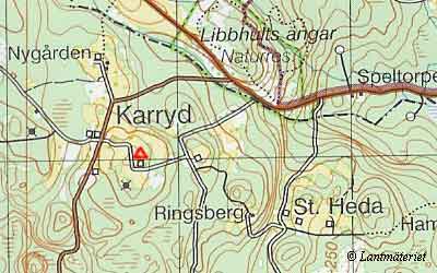 Click in the map to get a larger map!! |
|