
Provinces
Counties
Blekinge
Dalarna
Gotland
Halland
J—nk—ping
Kalmar
Kronoberg
Norrbotten
SkÍne
Stockholm
S—dermanland
Uppsala
Vðrmland
Vðstmanland
Vðstra G—taland
ørebro
østerg—tland
Other stuff
Home
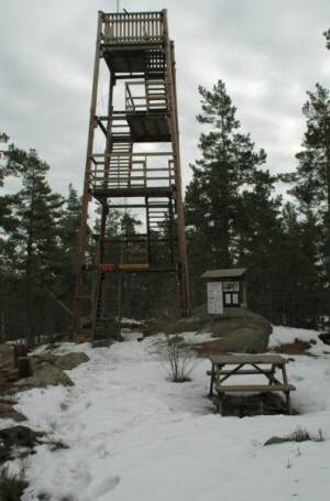
| S—dermanland: SkogsbyÍs - 124 m | |
|---|---|
|
Location: Northwest of Stavsj— Coordinates: N 58°47.444' E 16°19.664' Exact height: 124 m Hiking: Class 1 (What's this?) Hiking distance: 2.2 km loop Elevation gain: Approx. 50 m Map(s): Topographic: 9G SO Road map: Any road map All maps from Lantmðteriet |
 Click image to see more photos |
Approach:
From E4 in Stavsj—, follow the Skogsbyvðgen for 8.6 km to SkogsbyÍs. Park at the parking lot marked with signs for the S—rmland's Trail.Route: Follow directions and arrows for Skogsbyslingan at the trailhead. The highpoint is along stage 30 of the S—rmland's Trail (S—rmlandsleden). There is a lookout tower on the summit.Other: Jari Pyyluoma visited Skogsby and supplied some of the pictures. | |
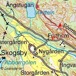 Click in the map to get a larger map!! |
|