
Provinces
Counties
Blekinge
Dalarna
Gotland
Halland
Jönköping
Kalmar
Kronoberg
Norrbotten
Skĺne
Stockholm
Södermanland
Uppsala
Värmland
Västmanland
Västra Götaland
Örebro
Östergötland
Other stuff
Home
| Kalmar: Grönsved - 292 m | |
|---|---|
|
Location: Northwest of Rumskulla Coordinates: N 57°44.075' E 15°30.775' Exact height: 292 m Hiking: Class 1 (What's this?) Hiking distance: 0.3 km roundtrip Elevation gain: < 10 m Maps: Topographic: 7F SO Tranĺs Road map: Any road map All maps from Lantmäteriet |
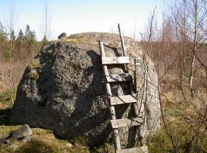 Click in the picture to see more pictures. |
Approach:
From Rumskulla (north of Mariannelund) in northen part of Kalmar County, drive northwest about 9 km to Grönsved. Pass the village and contine uphill. Park just before reaching the crest, either on the left or the right side. There is a possibility to reverse into the field at the P in the map and this way get off the road. Or you can just turn into the small road across the road.Route: Hike from the P along the road, pass the crest and reach a stone wall with really big stones. Turn right across the meadow behind the stone wall and hike in the direction of the pine trees on the other side of the meadow. The highpoint is about 130 m from the road, behind the trees, and it has a triangle marker. The rock in the picture above is about 2 m high and it is actually higher than the highpoint.Other: Situated in the neighbourhood is The Kvill Oak or the Oak at Rumskulla that is said to be the oldest tree in Sweden with 1000 years. Pay a visit to a National Park when passing by. N Kvill National Park is northeast of Grönsved. |
|
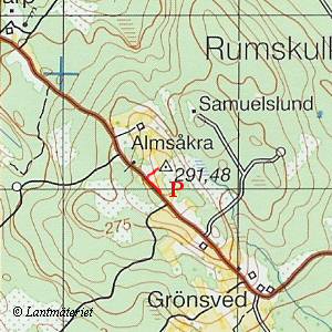 Click in the map to get a larger map!! |
|