
Provinces
Blekinge
Bohuslðn
Dalarna
Dalsland
Gotland
Halland
Lappland
Nðrke
SkÍne
SmÍland
S—dermanland
Uppland
Vðrmland
Vðsterg—tland
Vðstmanland
øland
østerg—tland
Counties
Other stuff
Home
| Vðstmanland: Fjðllberget - 466 m | |
|---|---|
|
Location: WNW of Grðngesberg Coordinates: N 60°05.722' E 14°54.984' Exact height: 466 m Hiking: Class 1 (What's this?) Hiking distance: 2.4 km round trip Elevation gain: 146 m Maps: Topographic: 12F SV Ludvika Road map: 124 Ludvika All maps from Lantmðteriet |
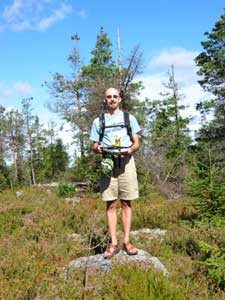 Click in the image to get a larger photo! |
K—ranvisning:
From Grðngesberg, follow route 60 south. Follow the signs to Fjðllberget's Ski Resort, appr. 4 km. Park at the ski resort's parking lot.Route: Hike up the dirt road. The are mobile phone antennas at the summit. |
|
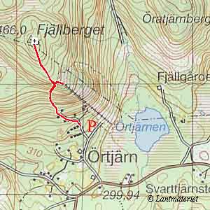 Click in the map to get a larger map! |
|